Gandia’s city walls tell the story of how a medieval town beside the Serpis became a ducal city equipped for artillery warfare. The Torreón del Pino, the stretches of wall near the river and several remains incorporated into the Centre Històric still reveal the enclosure’s two main periods.
Contents
Most of the defences disappeared as the town expanded in the 19th century, but their outline survives beneath streets, buildings and squares. Reading these fragments helps us understand the history of Gandia, from the foundation of the Christian town to the splendour of the Borgias.
The first wall: the medieval town beside the Serpis
After the Christian conquest of the territory, the population moved down from the area around the Castell de Bairén to the plain. The new settlement had no natural defences, so the Crown promoted the construction of an enclosure around the Vila. In 1255, Jaume I assigned a levy of 3,000 sueldos to the work; in 1308, Jaume II granted tax concessions to help bring it to completion.
Our guide to Jaume I and the birth of the medieval town explores the move from Bairén to the new urban centre in greater depth. The first fortification had a roughly rectangular layout, rammed-earth walls, a moat and square or rectangular towers. Its entrances included the Porta de la Mar, connected to the road towards the coast.
Francis Borgia and the Renaissance enclosure
Population and economic growth spread beyond the medieval perimeter during the 16th century. The Vila Nova extended outside the protection of the walls, while corsair raids and the use of gunpowder called for different defences. As the fourth Duke of Gandia, Saint Francis Borgia promoted an expansion begun in 1543 and documented as complete in 1564.
The second enclosure used stone and lime-mortar masonry, circular towers with sloping sides and gun ports for artillery pieces. It also protected the area around the future university and opened entrances such as the portals of Benipeixcar, Sant Lluís, Sant Domènec and València. Defensive architecture shifted from tall medieval walls to forms capable of withstanding and returning cannon fire.
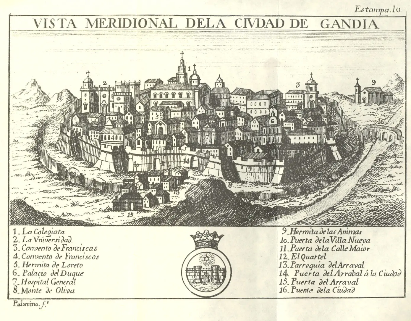
The demolition of 1880 and the modern town
Over the centuries, the walls lost their military purpose and eventually restricted Gandia’s expansion. Their demolition began in 1880 as part of urban expansion and sanitation works. The opening of the Passeig de les Germanies and growth towards the Plaça del Prado changed the relationship between the historic centre and the outer districts.
The demolition did not remove the entire defensive system. Some sections became party walls or load-bearing walls, while others remained beneath the paving. Urban excavations have documented foundations, stretches of wall and the base of a Renaissance tower on the Passeig de les Germanies.
The main surviving sections of Gandia’s city walls
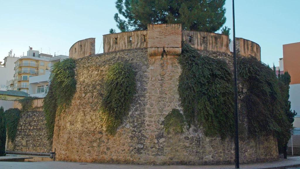
- Torreó del Pi or Torreón del Pino: this is the most recognisable surviving feature of the Renaissance enclosure. It stands between Carrer Sant Rafael and Carrer Alzira, next to the Escuelas Pías, and retains its circular form and artillery gun ports. The pine tree crowning it is part of its popular image; the current specimen was planted in 1989.
- Wall beside the Serpis: behind the Palau Ducal and the Monestir de Santa Clara, a stretch of the medieval enclosure and a tower survive. They can be seen from the area around the Avinguda d’Alacant and the Mirador del Serpis.
- Hospital de Sant Marc and Porta de la Mar: today’s Gandia Archaeological Museum (MAGa) occupies a building historically joined to the fortification. Its courtyard preserves medieval stretches of wall, and the complex incorporates the area of the former gateway.
- Carrer Pérez de Cullà: several remains were incorporated into buildings and party walls, including fragments associated with the Torreta.
- Carrer Duc Alfons el Vell: the route near the Palau Ducal preserves traces and structures that help identify the town’s historic boundary.
- Plaça del Tirant and Passeig de les Germanies: modern building works documented remains below ground. The finds beneath the Serpis car park do not form an archaeological site open to visitors.
A walking route around the vanished enclosure
The walk can begin at the Torreón del Pino and continue towards Pérez de Cullà and Duc Alfons el Vell. From the Palau Ducal, the route reaches the river to view the Serpis section of wall and ends at the former Hospital de Sant Marc. Some remains can be seen from public streets; others are incorporated into buildings or lie below the paving, so the signs deserve a careful look.
The Borgia Territory urban route connects the fortifications with the Escuelas Pías, the Palau Ducal and other places in the ducal town. Surfaces and access conditions can vary from street to street, so it is advisable to check accessibility requirements before setting out.
A protected monument that continues to emerge
The remains of the walls are protected as a Bien de Interés Cultural (Asset of Cultural Interest), in the Monument category. This protection covers both visible structures and hidden archaeological traces, which are essential for reconstructing the perimeter of the two fortifications.
The exterior can be visited freely, but admission to MAGa and occasional openings of the Porta de la Mar depend on their programmes. Check current opening times and prices on the official MAGa website and complete your plans with Visit Gandia.